Stamp, Log, Repeat: Building Your Personal Swiss Hiking Record From the Ground Up
There's a particular kind of satisfaction that comes from closing a journal, setting down your pen, and seeing a full page of trails you've actually walked. Not pinned on a wishlist. Not saved in a browser tab. Walked. If you've been visiting Switzerland across multiple trips — or you're planning to — building a personal hiking record isn't just a fun habit. It's one of the smartest planning tools you can have.
Swiss hikers have understood this for decades. And for American visitors trying to make sense of a country that packs an almost unreasonable amount of terrain into a space roughly the size of New Hampshire and Vermont combined, a good documentation system is the difference between feeling like you're making progress and feeling like you're starting over every time you land at Zurich Airport.
Why Tracking Matters More Than You Think
Let's be honest — most of us come home from a trip, dump our photos into a folder, and move on. A few months pass. You start planning the next Switzerland visit and realize you genuinely can't remember whether you did the Bachalpsee loop from Grindelwald or just thought about doing it. Was that the trip where you hit 2,500 meters? Or was that the one where the weather turned?
A hiking log closes that gap. It gives you a reference point for fitness, a baseline for elevation tolerance, and a clear picture of which regions you've already explored — so your next itinerary doesn't accidentally retread the same ground when there's so much more to cover.
Beyond the practical side, there's something genuinely motivating about seeing your accomplishments stacked up in one place. Switzerland has 26 cantons and a trail network that stretches over 65,000 kilometers. Tracking your slice of that? That's a long-game adventure worth documenting.
The Classic Approach: A Physical Trail Journal
If you're the kind of person who still writes grocery lists by hand, a physical journal might be your best move. You don't need anything fancy — a small hardcover notebook with grid or dotted pages works perfectly.
For each trail, aim to capture:
- Trail name and region (e.g., Five Lakes Trail, Pizol, Canton St. Gallen)
- Date and weather conditions
- Distance and elevation gain
- Starting and ending points
- Highest point reached
- Difficulty rating (Swiss trails use white, yellow, red, and blue markers — worth noting)
- Highlights or landmarks
- A personal rating or notes for next time
Leave a few lines for honest observations: how your knees felt on the descent, whether the mountain hut at the halfway point was worth the stop, what you'd do differently. Future-you will thank present-you for the candor.
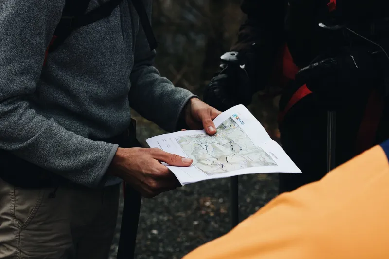
Some hikers also tape in trail maps, ticket stubs from gondola rides, or even pressed wildflowers. It sounds a little old-school, but a well-worn journal from three Switzerland trips is genuinely one of the more satisfying objects you can own as an outdoor traveler.
Going Digital: Apps That Actually Work for Swiss Trails
If analog isn't your style, the good news is that Switzerland is extremely well-mapped in the digital space. A few apps stand out for American hikers who want to track and document as they go.
Swisstopo is the gold standard for Swiss trail mapping. It's the official app of Switzerland's Federal Office of Topography, and the detail level is extraordinary — we're talking 1:10,000 scale maps with trail markings, elevation contours, and real-time GPS positioning. You can mark completed routes and download maps for offline use, which matters when you're deep in the Bernese Oberland with no signal.
Komoot is popular on both sides of the Atlantic and lets you record hikes, track stats, and build a profile of completed trails over time. Its route planning features are solid for stringing together multi-day itineraries, and the community-generated trail highlights are genuinely useful.
AllTrails has decent Switzerland coverage and is familiar to most American hikers already. The completed trails feature and personal stats dashboard make it easy to see your progress at a glance, even if the map detail doesn't quite match Swisstopo.
For elevation nerds, pairing any of these apps with a dedicated GPS watch — Garmin and Suunto both have strong followings in the Alps — gives you granular data on ascent rates, peak elevations, and total vertical gain across trips.
Organizing by Region: The Smarter Framework
Switzerland divides naturally into distinct geographic zones: the Jura in the northwest, the Swiss Plateau in the middle, and the Alps dominating the southern two-thirds of the country. Within the Alps, you've got major sub-regions like the Bernese Oberland, the Valais, the Graubünden, and the Ticino — each with its own character, trail culture, and landscape.
Structuring your log around these regions gives your documentation real shape. Instead of a flat list of trails, you start to see a geographic story: two trips focused on the Bernese Oberland, one deep dive into Graubünden, a summer week in Ticino. You can spot the gaps — maybe you've never hiked in the Jura, or you keep skipping the Engadine — and let that drive your next itinerary.
Create a simple regional checklist alongside your detailed trail entries. Even a single page with Switzerland's major hiking regions and checkboxes next to each gives you a satisfying overview of your long-term progress.
Setting Personal Milestones
One thing Swiss hiking culture does well is celebrate incremental achievement. You don't have to summit a 4,000-meter peak to feel like you've accomplished something meaningful — completing a multi-day route like the Via Alpina or the Haute Route is a serious achievement. So is hiking above 3,000 meters for the first time, or finishing trails in five different cantons.
Build your own milestone list based on what excites you. Some ideas to get started:
- Hike in 10 different Swiss cantons
- Complete a trail above 3,000 meters elevation
- Finish a multi-day route end-to-end
- Hike in all four seasons
- Log 100 total kilometers across Switzerland
- Reach a named summit in each major Alpine region
Milestones turn a collection of individual hikes into a larger narrative. They also make trip planning more intentional — instead of just picking trails that look pretty on Instagram, you're working toward something.
Bringing It All Together
The best documentation system is the one you'll actually use. Whether that's a leather journal stuffed with trail maps and coffee stains, a Swisstopo-powered digital archive, or a hybrid of both, the point is to create a record that grows with you across trips.
Switzerland rewards return visitors. The country is too layered, too geographically varied, and frankly too good to see in a single trip. A hiking log turns those return visits into chapters of a longer story — one where you can look back, see how far you've come, and look forward to the trails still waiting.
Start simple. Log your next hike. Then the one after that. Before long, you'll have something worth keeping.